# About
The meltwater contribution from snow and ice in mountainous regions plays a critical role in sustaining life downstream, supporting potable water security, agriculture, industry, hydropower generation and mining, especially in the current regime of climate change.
# Overall Objective
To effectively address this challenge, SNOWCOP leverages the full potential of the European Union Copernicus data and infrastructure to provide novel snow water equivalent (SWE) and ice melting rate maps with high spatio-temporal resolution, suitable to monitor meltwater dynamics in complex mountainous terrains.

# Methodology
Cutting-edge methods will be employed to extract valuable information about snow and glacier from satellite data, which will then be assimilated into a physically based model for snow and ice water equivalent estimation. The model will be run in a hindcast mode, generating reanalysis data spanning the past 20+ years at daily resolution. Notably, the proposed approach yields SWE maps over a 50-m pixel size, achieving an unprecedented level of spatial detail for the vast area of the extra-tropical Andes Cordillera.
# CDSE
The Copernicus Data Space Ecosystem (CDSE) (opens new window) infrastructure, which houses both processing facilities and a comprehensive data repository, serves as the backbone for this project. CDSE will be populated with all the necessary codes, in-situ data, and third-party space data, enabling the seamless extraction, processing, and analysis of mountain cryosphere-related information. To further enhance accessibility and utilization, a user-friendly and standardized API and a robust dissemination strategy will be implemented in collaboration with key public authorities in Europe and South America. This strategic approach aims to attract new users from both the scientific and commercial sectors, ensuring that the project’s valuable data and insights reach a broad audience.
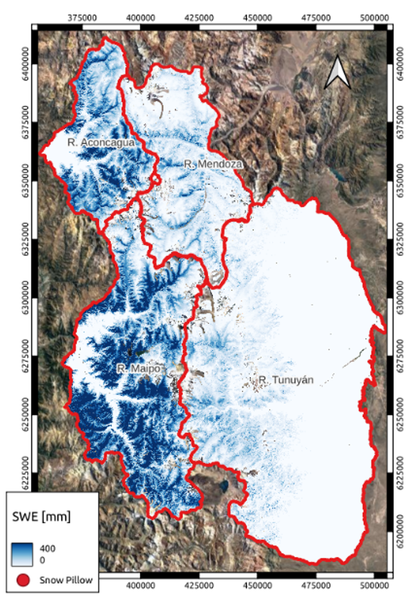
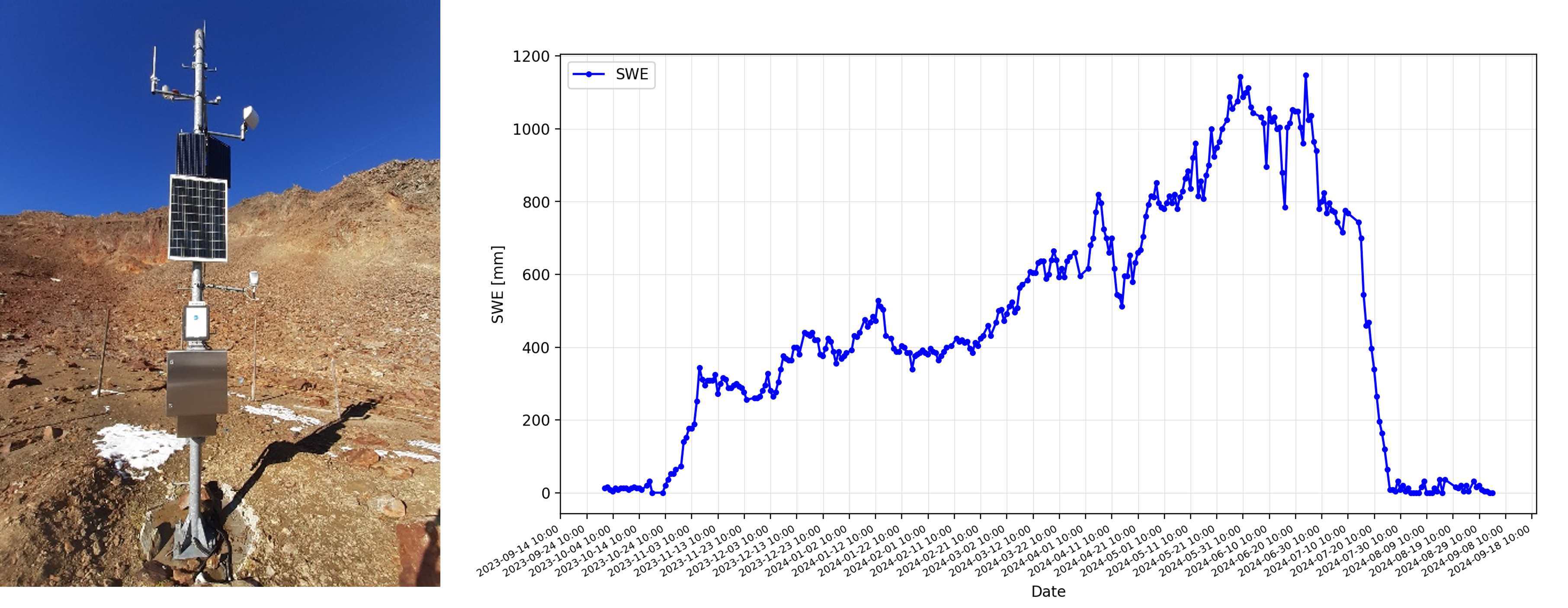
# EGNSS snow stations
SNOWCOP will leverage innovative snow stations powered by EGNSS technology to reinforce in-situ measurements of SWE and liquid water content (LWC). These stations will be positioned on locations that optimally represent the snowmelt dynamics within a specific catchment based on the project generated reanalysis data.
# Impacts
Focusing on the critical Andes Mountain range, where meltwater serves as a vital lifeline for millions of people but remains poorly monitored, this initiative leverages the expertise of the International Copernicus partners at the University of Chile. Through this collaboration, we tackle shared challenges faced by mountain regions globally, developing replicable solutions that unlock new opportunities for both local and European communities.